An interesting problem to solve…
Imagine this… I am on a 15 hour flight from Doha to Atlanta. There is a TV screen with a lot of movies but I do not watch movies. There are my favorite shows like Big Bang Theory, Friends etc but how many times can you see the same 10 episodes? Remember, I had to take a 15 hour flight going to Doha too. And I do this multiple times a year.
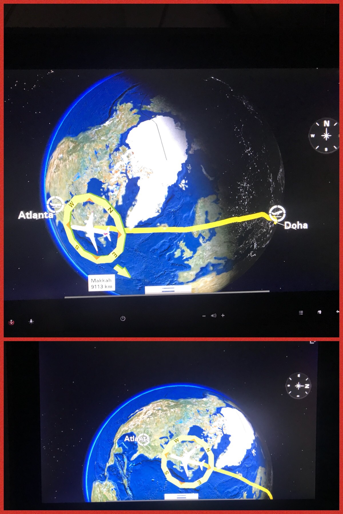
So, I was lazily looking into the progress of the plane on the map of the globe. It was showing on the globe where we were and our trajectory. Notice the picture on the top half. As you can see, we were somewhere around the New Foundland area in Canada.
Here is the problem:
I was trying to ascertain roughly where the north pole was in that map. Just to see how close did we go to the north pole. The problem is in this map, all of Greenland and the Arctic area is shown as one white blob.
I also want to let you know that the screen is a smart one like you have in iPad. You can use one finger to go left and right and using two fingers, you can make the globe rotate (on any axis – depending on how you swipe both fingers). As an example, I used my two fingers and slid them up and a little to the left. As you can see in the picture in the lower half, the world rotated on a horizontal axis and rotated to the left. You can notice how North America moved up and then the North pointer in the compass turned by 90 degrees.
The point is, using the two fingers, you can turn the globe on any axis as you want (going thru the center of the earth).
Using this, can you pinpoint where the North Pole is?